DIESEL, DUST AND DHABAS
Next time I go on holiday I want to go on a normal one. But what is a normal holiday? To some it is sitting on a beach while others need some action and exercise. Normal for me is cycling or walking somewhere in the world but after this last trip I just want to find a beach somewhere. You see I have just returned from ten days cycling through the Indian Himalayas from Leh to Manali.
Adventure is in my blood, nothing serious but just a little challenge now and then. I spend all my holidays walking and cycling and, as a travel agent, I also sell walking and cycling holidays. Three years ago I cycled down the Karakorum Highway from Kashgar in China to Islamabad in Pakistan. This was a reasonably challenging cycle with one high pass, the Kunjerab Pass, at 4700 metres. Leh to Manali, however, is the world’s second highest motorable road and has four high passes, with the highest being 5328 metres and the lowest being just 3978 metres. And it is only half the distance of the Karakorum Highway.
There are only two roads to Leh, one from Srinagar and one from Manali. I had been to Leh twice in the early eighties when I was leading Trans Asia expeditions from Kathmandu to London. Then, it was the tortuous road from Srinagar, which wound its way over three high passes followed by a dusty track alongside the Indus river. Then, the road from Manali was closed to foreigners as it was the military supply road to the northern areas. But now it is open and three years ago I started planning the logistics of cycling it but wasn’t sure if I should start in Leh or Manali.
The runway in Leh has been upgraded and now there are a number of airlines operating wide-bodied jets. They depart Delhi before 0600 so you have to be a morning person. I had booked my Jet Airways business class seat in Australia, not because I am rich but I needed the extra baggage allowance to get my bike on board for free. Security was very tight in both Leh and Delhi due to the high military presence in Ladakh. It was only an eighty minute flight but it was one of my best. Way below me there were snow clad peaks everywhere and I tried to picture the road I would be cycling down in a few days. In the distance I even glimpsed K2, the second highest mountain in the world.
I was looking forward to haggling over the price of the taxi into town and was very surprised to find out that it is now a fixed price and you prepay at the airport office. Where’s the fun these days? Leh is at a height of 3505 metres so I took it easy as I carried my bike and panniers to the taxi. I didn’t want to drop dead just yet!
My companions, Alasdair, Graeme, Gordon and Trevor were already in the hotel as they had flown in from Scotland two days earlier. But they were still asleep when I was dropped off. So I ordered my breakfast of omlate (sic), toast butter jam and black tea and then relaxed in the garden under a shady tree. It was only eight o’clock but already the sun had a bite in it, not to mention a high amount of UV as well.
Leh is a noisy and dusty town with narrow winding streets where vehicles speed along with beeping horns and without an obvious care for pedestrians. Vehicles rule and the bigger you are the faster and noisier you can drive. They also belch diesel fumes and mixed with the dust and the high altitude you have a good healthy start to your day! Dogs roam everywhere, scavenging, and at night the barking, sometimes in unison and sometimes individual, soothes you off to sleep and then wakes you up again. Part of the fun and excitement of travelling to remote places.
Three of the highest motorable passes in the world are within 100km of Leh. The highest is the Kardung La (5620m) followed by Chang La (5599m) and then the Taglang La at 5328m. La is the Tibetan world for pass. Kardung La by bike had been a dream of mine for a long time and now I was sitting on the balcony of my hotel in Leh eyeing the road as it twisted its way up the nearby mountain. From Leh it was a 2000 metre climb in just forty kilometres. The others did it the day after I arrived, eight hours up and two down and were totally shagged when they arrived back. I was very surprised with their success as they had only arrived three days before which I felt was just not enough time to acclimatise. However, three of them were taking Diamox tablets which aid acclimatisation. Graeme wasn’t and he was physically sick near the top but made it nevertheless. I managed half way up the next day and that was my only chance as time was against me.
We had all brought our own bikes and camping equipment and were totally self-sufficient. I only put my tent up once as I slept out under the stars when we were not in hotels or dhabas (tea-shops and basic accommodation). Although we had two stoves and cooking equipment, it really wasn’t necessary. At lower altitudes these Dhabas were permanent buildings but higher up they were parachute tents and were only temporary during the summer months. There were literally ex military parachutes made into a tent like a marquee.
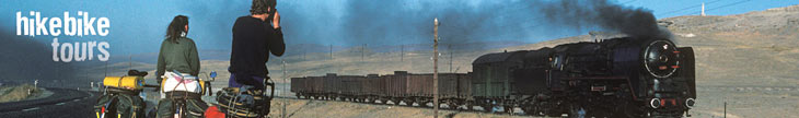
From Leh we cycled along the Indus River past the monasteries of Shey and Thikse. We also passed the world’s highest golf course where the fairways were all sand and the greens, some kind of tar. Imagine playing nine holes where every shot is a bunker shot? It wasn’t a busy road but it was hot and dusty with some diesel fumes thrown in for good measure. That night we camped in the grounds of the famous Hemis monastery which is hidden in a secluded and beautiful valley. We had cycled just thirty eight kilometres in eight hours with the last seven from Karu to Hemis taking about two. Cycling at altitude is much easier than walking although on many occasions I had to dismount and push my bike. The ride down next day to Karu took only thirty minutes.
There were four passes to be crossed on the six hundred kilometre cycle from Leh to Manali. The first one is the Taglang La (5328m) followed by the Lachalung La (5065m) and then the Baralacha La (4890m) with the final and lowest one being the Rohtang La (3975m). The last one is the divide between monsoonal India and the high altitude desert of Ladakh and Zanskar.
The next two days were uphill to the Taglang La but then it was downhill followed by many ups and downs, plus headwinds of course, to Pang. Pang is a dusty collection of dhabas where we feasted on soup, parathas, rice, dhal and endless cups of black tea. Although I counted the kilometres, time was the best measure of our progress. Our longest day was eighty seven kilometres and shortest, twenty seven but both days took the same number of hours.
The Lachalang La saw it raining and as we descended the twenty one hair-pin bends of the Gato Loops it became rather heavy and cold. This was a very dangerous descent where any lack of concentration would see me off the edge. My fingers were constantly curled around my brake levers and I was very aware that braking in the wet is about fifty per cent less effective than when it is dry. Indian roads are not smooth and I was always looking down trying to avoid the constant potholes. At the same time I had to keep looking ahead to see where the next 180 degree bend was and to look for any trucks or buses chugging uphill. I use a mirror in which I was constantly checking for suicidal downhill truckies. We regrouped at the bottom all shivering and wet. It was then twenty four kilometres against the wind to Sarchu, a motley collection of dhabas and a police checkpoint. To ease the pain I dreamt of relaxing on some tropical beach!
The day before Baralacha La was the hardest. We only cycled twenty seven kilometres but it took six hours. It was raining, it was cold, the road was potholed and we crossed many landslides which were still moving. Low flying cloud obscured what must have been a tremendous vista of high snow clad mountains. I was wet and cold and struggling with the altitude (from 4000 metres to 4500 metres) but I knew I had to keep going. A broken spoke or a puncture would have been impossible to fix.
Buses do the trip in two days with overnight stops at Sarchu or Pang depending on which way you are going. It is a very busy road with many trucks and buses continually moving goods and people up into the mountains. Initially there was a lot of traffic which meant we had to be careful. Buses stopped for the night but many trucks kept going which meant our peaceful camps were not as peaceful as we would have liked. Some of these drivers drove the whole two days with only a few stops for refreshment and toilet. No log books over there! On the third day we found out that there had been a landslide just above Manali which had taken out a bridge and several kilometres of road. This was good news for us but bad for the local economy. The good news for us meant that there was only a few local trucks and buses sharing our road.
Manali was the end of the trip and it was only fifty kilometers downhill from the Rohtang La. But it wasn’t that easy. There was a sting in the tail. At the Rohtang La we went from bright sunshine to moisture laden clouds within one metre. We were now in the monsoon. It was raining and it was cold and very misty and we knew that we still had to carry our bikes and gear down the bypass of the slip. Suddenly out of the mist we were mobbed by hundreds of local porters vying for our business. It was a fairly steep slope and looked very treacherous. We weren’t really in a position to bargain and Trevor just agreed on the price and set off with two porters carrying his bike and gear. I hired one porter and thought I could carry my own bike but I soon realised I was in trouble and hired another porter. It was a treacherous slope made very slippery with the rain but after ninety minutes of slipping and sliding I arrived at the bottom covered in mud and scratches. My bike and gear arrived without any damage.
I put on new brake blocks before freewheeling down the last fourteen kilometres to Manali. After a three kilometre uphill ride we found the Dragon Hotel which had been recommended by two of my clients I had surprisingly met in Leh. A hot shower was followed by beer on the balcony. The temperature was just perfect and we just sat there taking in the surrounding beauty and relaxing. It was over!
This was one of the hardest holidays I have ever been on. I have always wanted to cycle in Mongolia so maybe next year I will go cycle with the nomads. Or maybe I will just go to Koh Samui.
Sunday, October 24, 2010
Monday, July 26, 2010
Walking in the Highlands of Scotland
The year is 1692. The place is Glencoe. It's dark, it's cold, it's misty and fresh snow lies on the ground. The MacDonalds and their guests the Campbells are asleep. Suddenly the night is filled with screams. The Campbells are murdering the MacDonalds. Women and children are not spared in the carnage which follows. Those clansfolk who do escape, freeze to death in the surrounding mountains. The Massacre of Glencoe is history now but it is very easy to picture the scene as you walk through this most haunting of Scottish glens.
Glencoe still retains much of this aura and is one of the most popular destinations in Scotland. Unfortunately most people just glimpse it as they speed through on their luxury coach. They will stop at the visitor centre, buy their postcard and sign the visitor's book before driving to their luxury hotel in Fort William knowing they had at last 'seen' Glencoe. However, to experience the real Glencoe, the weather, the atmosphere, the remoteness, you have to don your boots and backpack and follow the peat coloured burns, through the blooming heather and up into the lonely corries.
The West Highland Way is Scotland's first long distance footpath and passes through Glencoe on its way north to Fort William. The walk starts on the southern shores of Loch Lomond and whether you take the high road or the low road the path contours majestic Ben Lomond through forests of birch and oak and takes you along the 'bonnie bonnie banks' of this immortal loch.
Crianlarich, pronounced exactly as it sounds, lies at the base of Ben More (3825ft), and is a popular stopping point for walkers, as well as motorists and train enthusiasts. Two major roads, the A85 and A82 meet here and there is a train station, Youth Hostel, campground, hotels, and many bed and breakfast establishments. Enjoy good home cooking followed by a beer or a dram in the friendly 'local'.
The path then follows the railway line and the road northwest through the narrow confines of Strath Fillian to Tyndrum. Both road and rail split here. One line follows the A85 west to the seaside port of Oban and the other line follows the A82 north and immediately climbs across open heather moorland toward the desolate Rannoch Moor. However as you contour below Ben Challum (3354ft) you can't help think how fortunate you are out there in the open challenging the elements knowing that most visitors to Scotland never experience this unique outdoor experience.
Despite their comparatively low altitude, the Scottish mountains are potentially hazardous and subject to rapid weather changes. Such changes can make a simple walk up an easy hillside into a serious undertaking requiring a high degree of mountain skill in route finding with both map and compass. The weather of the Scottish mountains should never be underestimated and makes proper clothing and equipment essential.
The countryside becomes bleaker as you continue ascending to the hamlet of Bridge of Orchy below the conical peak of Ben Dorian (3524ft). You are now on the edge of the Rannoch Moor. Further on the route passes the popular Inveroran Hotel which offers food and overnight accommodation. From here to the Kingshouse Hotel you are on your own with only the other walkers for company. You pass Forest Lodge as you contour around lonely Loch Tulla toward the Black Mount. The silence is almost deafening as you take in the beauty and the remoteness which surrounds you. Photographs can't do justice to this timeless landscape.
A strong northerly wind on this section can make it one of the hardest and perhaps most rewarding day on the walk. Scotland has four distinct seasons and it is very possible to experience them all in one day, if not in one hour. Snow can and does fall at any time of the year even though people could be playing on the beach relatively close by. The weather pattern is generally from the west with the Gulf Stream and the mountains creating a very high degree of precipitation. Generally speaking, northerlies bring cold air from the Arctic throughout the year and easterlies can bring cold in the winter and warm in the summer.
It is important that all walkers/climbers are aware of the potential dangers in the Scottish mountains and are properly prepared and equipped to deal with them.
After many hours of walking, you will see the welcome sight of the Kingshouse, probably the loneliest hotel in Scotland and, like a sentinel, guards the entrance to Glencoe. With the thought of steaming hot broth and a glass of whisky you quickly descend to the hotel.
The Kingshouse was built in the 17th Century and is believed to be one of Scotland's oldest licensed inns and is as much part of the landscape as the mountains themselves. It has an atmosphere all of its own and many a tall tale has been told at the bar. If the weather is kind to you, you can sit outside and watch the climbers on the cliffs of Buachaille Etive Mor (3345ft). Whether you spend a night here or just pause for a cleansing ale you will never forget this place for as long as you live.
The actual township of Glencoe is further on down the glen on the shores of Loch Leven. Here you can find a Youth Hostel, several bunkhouses offering accommodation of all kinds, campsites, hotels and of course the ubiquitous Bed and Breakfast. To experience Glencoe and all its moods a few days should be spent here enjoying the scenery, the people, the culture and the history.
The Devil's Staircase will take you over the hills to Kinlochleven which literally translates into 'the town at the head of Loch Leven'. The Mamore Forest Lodge is situated high above the township and offers some superb views down the loch to the impressive peak of Ben a' Bheithir (3361ft). Again it is possible to spend a night here or just break for lunch before the last fourteen miles to Fort William.
The mountain range you cross to reach Glen Nevis is called the Mamore Forest, an unlikely name considering there is hardly a tree in sight. Once in Glen Nevis you can wander down the river of the same name until you reach Fort William. After seven days of walking through some of the wildest country in Europe you can now have a rest before tackling the challenging ascent of Scotland's highest peak, Ben Nevis.
At 4406 feet "The Ben", as it is known amongst the local walking fraternity, requires respect whether walking up the 'tourist' track or climbing on its precipitous north face. The temperature on top can be as much as 20 degrees lower than in Fort William. This is a potentially very dangerous mountain and extreme care and precaution are required at all times. For six days out of seven the summit is shrouded in mist. Of course you can't pick that illusive day but if you do, you will be rewarded with one of the most memorable views in the world. However if you are unfortunate with the view console yourself with the thought you are not alone and that the ascent itself is a rewarding challenge.
Wherever you walk in Scotland, whichever Ben you climb, whatever the weather, you will return home having experienced some of the most rewarding walking in the world.
For more stories and travel advice go to my homepage at www.hikebiketours.com.au
A walk in the Tatra Mountains
"One person on a chain at a time, three points of contact and just don't look down!". The zig zagging path up the scree slope had stopped. Above us towered 500 feet of cliff and as I ascended, I thought of the song 'A Stairway to Heaven', only our heaven was a saddle where we would stop for a well deserved picnic lunch. And just as our guide, Jacek, had said, it was easy; just take a step at a time, move your hand up the chain and, of course, don't look down. The adrenalin was pumping and the excitement rising. I was too busy concentrating and enjoying the challenge to worry about any fear I had. Twelve people snaking their way slowly upwards.
Climbing up the cliff face became easier as we found our rhythm. When one person stopped, we all stopped, just like cars in peak hour traffic. Eventually our group of six Britons, one Irishman, one American girl, myself and our three Polish guides arrived at the saddle. A sheltered spot was found and as we hungrily ate our picnic lunch, I couldn't help take in the beauty and the peace of the surrounding peaks. They reminded me of a misspent youth climbing and walking in the haunting Cuillin mountains on the Scottish island of Skye.
This was our fourth day of a two week walking holiday in the Tatra mountains. These rocky limestone and granite mountains straddle the border of Poland and The Republic of Slovakia with the highest peak, Gerlachovsky Stit, 2655m above sea level.
A few days earlier we had arrived into Warsaw during a heat wave. It was 36 C with the mercury still climbing. Immigration and customs were unbelievably easy and once the group was gathered together by Jacek, we were on the express train to Cracow.
What a wonderful city Cracow is! Ancient castles, world-class museums, beautiful art galleries and towering churches were all within walking distance of our hotel in the heart of the old town. Well this was a walking holiday and what better a way to begin than by walking around town although we must have seemed an odd sight wearing our heavy boots in the 38 degrees.
The huge equestrian statue of Count Tadeusz Kosciuszko, above the ramp into Wawel Castle, reminded me of Australia's highest mountain, which was named by Count Strzelecki because it resembled the large earth mound over the tomb of Kosciuszko.
En route to Zakopane, our base for exploring the Polish Tatras, we stopped at the small industrial town of Wieliczka. Here we explored a 1000 year old underground salt mine where many of Poland's art treasures were hidden during the war. We investigated the many theme chambers including the St. Kinga Chapel, which took 30 years to carve, measures 54 by 17 metres and is 12 metres high. A change of pace from the usual museums and art galleries one normally visits when travelling.
Our lodge in Zakopane was very reminiscent of a Swiss Chalet. All bedding was supplied throughout the trek and most meals, including pack lunches on all trek days, were included. The meals were plentiful, high in carbohydrates, typically Polish and even the hungriest of us couldn't eat everything put in front of us.
Every day we explored a different valley, climbed onto the rocky ridges and descended into another valley for the walk back to the chalet. As in many other parts of Europe all paths are colour coded and are very easy to follow even during inclement weather. It was forbidden to walk off the trail and signs in Polish warned of the consequences. None of us argued with this and it seemed the locals didn't either.
Like all mountain ranges throughout the world the weather in the Tatras can change at any time and did just that on a number of occasions. We experienced blue sky, sunshine, rain, hail and blizzards all in one day. From shorts and t-shirts to woollens and waterproofs within the hour.
One special night was spent away from Zakopane in a beautiful mountain chalet nestled amongst tall pine trees next to a little glacial lake. This mountain chalet, like the many we were to stay at in the Tatras, had dormitory accommodation, served hot meals and drinks, was well heated and even had hot showers!
Our single 'rest' day came from a rafting trip down the Dunajec river. Not exciting thrills and spills usually associated with rafting but a very pleasant journey in traditional rafts through narrow limestone gorges. The river wound its tortuous way along the border with Slovakia and on several occasions our captain explained we had illegally crossed the border. He also talked about the old days when people were shot while trying to escape from one country to another. We were all quite thankful times had changed and that the Iron Curtain no longer existed.
The official border crossing into Slovakia was easy. Three years ago this would have taken many frustrating hours but 'Glasnost' had stopped the bureaucracy and red tape. 'Plan maximum', as Jacek explained in his endearing English, was for a very long walk up a valley and then over a high pass to Szielsky Dom Chalet. However due to the incessant rain and very low cloud cover we had to revert to 'plan minimum'. This involved taking a bus around to the southern side followed by a short walk up to the chalet.
As we ascended, the rain turned to sleet, the sleet to snow and before long the path had disappeared under a pure white blanket. As we all donned our Goretex waterproofs, Jacek and the two other guides pulled out their umbrellas! I have this great photo of Jacek huddled under his umbrella protecting himself from the elements with only a pair of sandals protecting his feet. It was a little hard to accept that we all had the modern high tech gear which they just could not afford.
I was breaking the trail with visibility down to about twenty feet when suddenly the chalet just loomed out of the blizzard. As we walked through the door covered in snow it was a tremendous relief to see our baggage waiting for us. The brochure description was reading well!
Once allocated to our heated rooms we indulged in wonderfully hot showers followed by hot tea and coffee in the restaurant. Walking in the mountains wasn't meant to be this easy but then again what's wrong with a little luxury now and then.
Gerlachovsky Stit was our objective the next day but the mountains were still shrouded in mist and snow was still falling. As the ascent involved the use of chains and ladders on the more difficult sections, Jacek deemed it too dangerous an expedition. 'Plan minimum' again came into operation and we spent the extra time building snowmen, or should I say snowpersons, with the odd snowball fight thrown in.
The last five or so days were spent in the mountains walking from chalet to chalet. However there were two overnight stays at more rustic chalets where we didn't have access to our main baggage. Even though our daypacks were heavier, this was more than compensated for by the charm of the beautiful mountain settings.
The mist still clung to the high peaks and we all enjoyed the fun and stimulation of breaking trail on the lower level paths. Rather than going up and over to the next chalet we contoured around the mountains. Plan minimum was operating again but we had no complaints as we were all experienced walkers and were used to the vagrancies of the weather.
As we descended out of the High Tatra the mist lifted, blue sky appeared and the peaks shone in their new winter coating. I have spent most of my life walking in the mountains of the world and it is amazing how often this phenomenon happens as you turn your back to go home. However there wasn't one of us who would have wound the clock back to start again. The feeling of camaraderie amongst the group was greater than what could have been at a different time.
Our penultimate day was spent enjoying a relaxing walk in the beautiful Slovensky Raj, a National Park located a few kilometres away. The weather was just perfect and the path followed the meandering river across footbridges, up and down ladders and along catwalks clinging to the cliffside above the river. The different shades of green contrasted so much to the white landscape we had just left.
After a shower and a meal it was time to board the overnight train to the magical city of Prague. This city is pure history and survived both wars almost unscathed. History is everywhere as you walk along well worn cobbled streets looking at the wealth of Gothic and Baroc architecture. Remove the cars and it would be easy to imagine you were living 200 years ago!
All good things come to an end and as the group took off for London I was boarding the night train south to Vienna for the next stage of my holiday. Walking is a wonderful way of staying fit and combined with a holiday it cannot be bettered. However, add to it the novelty of a new culture and you have an experience you will treasure forever.
For more stories and travel advice go to my homepage at www.hikebiketours.com.au
Subscribe to:
Posts (Atom)